House Names and Numbers
Does your house have a name as well as a number? There was a time
when houses in Chaddesden had neither. There was not much point when
few people could read and everybody knew where everybody else lived. A
few people lived in houses named after their trade – The Mill, The
Bakehouse – otherwise “John's house” might suffice for indentification.
The enclosure and creation of farms produced a new set of names –
The Farm is not of much use for identification when there are over ten
of them – hence names based on their location in the parish – Hall Farm,
Hill Farm, Meadow Farm, Moor Farm, Wood Farm to mention a few.
The increase of literacy and the introduction of the universal postal
service from 1840 made house names more useful. An address like “Moor
House, Chaddesden, near Derby” would be sufficient to ensure delivery of
your post when Chaddesden had fewer than 100 houses and the population
was less than 500. The village postman probably knew where everybody lived.
The construction of two rows of cottages at the end of Highfield Lane by
the Midland Railway around 1865 saw house numbers used in Chaddesden for
the first time. With thirty dwellings of similar style, the obvious
thing was to number them consecutively 1 to 30. As railway employees
moved from place to place in connection with their work and some of the
cottages having lodgers, it was no longer realistic to expect the
postman to know where everybody lived.
By the late 19th century, house numbers had become the normal method of
distinguishing houses in long terraces in towns. Wealthier residents,
who could afford an individual house, often gave it a name although it
would most likely have a number as well. In this way, houses with names
came to be seen as superior to those without.
When land along Chaddesden Park Road was sold for house building, the
plots seem to have been numbered 1 to 15 from Nottingham Road to the
intended junction with Mayfield Road, but it was a number series for the
entire estate and the numbers continued with 16 to 29 from midway along
Mayfield Road to Roe Farm Lane. As some people bought two plots to
build a bungalow or a larger house, the plot numbers were of little use
for indentifying houses. To emphasise their individuality, the new
residents gave their houses names. Here are some of the names that were
used on the north-west side of the road between Nottingham Road and
Northwood Avenue.
| Allington |
Bryn |
Davirust |
Park View |
| Beau Vale |
Bryntirion |
Emburn |
Penlee |
| Brentwood |
Chellow Dene |
Glenavon |
Rose Villa |
| Brooklyn |
Conifer |
Lynwood |
Strathney |
Of course, the houses were not named in alphabetical order. Park View
was the first house from Nottingham Road while Davirust (whatever that
means) was at the far end of the series. Incidentally, the latter was the residence of
William Francis Dowling, headmaster of the village school.
Imagine the difficulty for the postman in sorting the post as more houses
were built and more names added at random.
Matters were put in order when this part of Chaddesden was taken over by
Derby County Borough in 1928 and house numbers were allocated in the
conventional way, serially from the town centre outwards with odd
numbers on the left hand side of the road and evens on the right in the
direction of increasing numbers. On Chaddesden Park Road and Mayfield
Road there were a lot of undeveloped sites so the higher numbers were
allocated in a second block beginning at 102.
Mayfield Road and Northwood Avenue residents, whose houses had been
identified by builder's plot numbers seemed happy to accept their new
house numbers but those who had lived on Chaddesden Park Road from new
were attached to their house names which were still used in the early
1930s instead of numbers. The Derwent Ward electoral register in the
early 1930s still contained mainly house names on Chaddesden Park Road
making it hard to determine who lived where.
Sometimes it took a house sale after which the new householder used the
number rather than a name that had no significance to them.
On Colliery Lane, which ran along the north east boundary of the New
Cemetery, the builder's plot numbers ran consecutively from 7 to 46.
Derby Corporation allocated house numbers 6 to 84, evens only, but the
residents were dissatisfied with the street name which they claimed
inferred a connection with mines. (15 years earlier it had been the
access to the Derby Kilburn Colliery Company's depot.) The new name
chosen was Cumberland Avenue in keeping with the county name theme of
the adjacent streets which shows that names are not always popular.
Large-scale housebuilding in Chaddesden in the early 1930s led to many
hard-to-find addresses. There were long roads along which the houses
were identified only by name – Albert Road, Reginald Road, Nottingham
Road, although the eastern part of Nottingham Road was known as Cherry
Tree Hill. Chaddesden was hard work for postmen and delivery drivers.
In November 1933 Shardlow Rural District Council considered a recommendation from
the Postmaster of Derby for house numbers to be introduced in Chaddesden.
The surveyor was instructed to allocate a number to every house. Like his
counterpart in Derby, the surveyor faced opposition from residents who
were attached to their house names. On some streets, house names instead of
numbers were still in use at the start of the Second World War.
It took a war for common sense to prevail and the postman's job be
made easier when delivering the morning post in blacked-out streets.
Some Unusual Features of the House Numbering System
A quirk of Chaddesden house numbers is the omission of number 13.
The next house after 11 is 15. Some local authorities do
this to avoid requests from superstitious residents to renumber their
house from 13 to 11A although it might be thought that 11A is less
desireable than 13 as it suggests a sub-divided property – 11 and 11A were
once one larger house or 11A has been built in the large garden of number 11.
Edward Avenue has clockwise numbering. The first house on the left is number 1 in
the usual way, next door is number 2 and the numbers continue in sequence until 12 which is
the first house on the right, in other words, clockwise on a map. Clockwise numbering is
sometimes used in cul-de-sacs when there is no prospect of the road being extended.
As far as we are aware, Edward Avenue and Highfield Cottages are the only occurrences
of sequential numbering in Chaddesden.
Where in Chaddesden will you find house number 12 with number 14 on both sides and 14 with
12 on both sides?
At empty sites Derby Corporation's practice was to leave gaps in the numbering
to allow for numbers to be allocated when houses were built later. This is encountered
on several streets off Chaddesden Park Road. After 12 Chaddesden Park Road
there was an empty site before the junction with Hanbury Road, then more empty sites before the
first house which was allocated number 14 Hanbury Road. That remained the case until the 1950s
when two bungalows were built on the empty sites - 14 Chaddesden Park Road and 12 Hanbury Road -
hence the sequence 12, 14 Chaddesden Park Road followed by 12, 14 Hanbury Road.
There are missing numbers on the other side of Hanbury Road, too. No 11 was the first allocated
and the empty site was not filled until bungalow no 9 was built after the war. 1 to 7 and 2 to 10
Hanbury Road do not exist. The same happened on Oakleigh Avenue where the first odd number was so
far along the street that it was numbered 17. The intervening gap was later filled with two
semi-detached pairs but somebody did not understand the principle of the numbering system. The
later houses should have been numbered 9 to 15, working backwards from 17. Instead they are
numbered 1 to 7 although the largest separation is between no 1 and 18 Chaddesden Park Road.
Chaddesden Park Road itself has numerous missing numbers due to the way that it was built.
The first houses on the east side were numbered 102 upwards with the lower numbers being added
later. The building plots were sold individually and some people bought two so they could build
a bungalow or a larger house which results in more missing numbers. The certainty with house
numbering is that the numbers increase in one direction, in this case away from Nottingham Road,
but the numbers may increase faster than expected.
Another convention is that houses are numbered from the town centre outwards. This can be
seen in the streets leading off Chaddesden Park Road. With one exception, the low numbers
are at the Chaddesden Park Road end. The exception is Arridge Road which is numbered in the
direction of construction, from Reginald Road towards Chaddesden Park Road.
Houses on corner plots are numbered on the street from which pedestrian
access is gained. Vehicle entrances are not a reliable guide as they may be at the side or rear of
a property. This is demonstrated on Chaddesden Lane where numbers 39 and 41 do not exist.
The house sharing a party wall with 37 Chaddesden Lane is 1 Richmond Road, while 2 Richmond Road
is party with 43 Chaddesden Lane. Although all four houses face Chaddesden Lane, the two in the
middle have access from Richmond Road. Sometimes builders build a semi-detached pair at an angle
to both streets at a junction which makes it clear that one house is allocated to each street.
Max Road is another that is numbered in the dirction of construction, toward the town centre,
starting with numbers 1 and 2 at the junction with Wood Road and ending with numbers 229 and 276
at its junction with Sussex Circus. That junction confuses some people as what appears to be the
same road is Max Road, Sussex Circus and Hereford Road in quick succession.
Sussex Circus has clockwise numbering, but with odd numbers only, starting at the first house
built, number 1 at the junction with Berkshire Street.
Hampshire Road, which has an end-on junction with Hereford Road, was originally numbered
from the town centre outwards, with numbers 1 and 2 at the junction with Beaufort Street.
When Hampshire Road was extended to Kinross Avenue and then across the racecourse to Mansfield Road,
the houses on the extension would have negative numbers. The solution was to renumber the houses
from the Hereford Road end towards the town centre. Numbers 1 to 27 on the north side of the road
became 28 to 2 in that order, while numbers 2 to 18 became 17 to 1.

A corner house designed by Charles Aslin, Derby Borough Architect with the houses at a
right angle to each other so the party wall is the side of one house and the rear of the other.
The house on the right is 2 Worcester Crescent; that on the left was originally 27 Hampshire Road
but now 2 Hampshire Road.
One of the most awkward streets to number was Ravenscroft Drive which runs in both
directions from a junction with Richmond Road. The plan was for the southern branch to do
a u-turn, head in a northerly direction to a junction with the northern branch and then
continue to end at a junction with Ismay Road. When construction began in 1933 the
houses were identified by names only. The problem when numbers were assigned, was where to
begin the numbering series. The starting point chosen was the most recently built houses on
the southern branch, regardless of the plan for the street to continue beyond that point.
Within a few years, two houses had been built beyond number 1. For some years they were
known as plot 36 and plot 37. The solution adopted postwar was to use a new street name,
Rushcliffe Avenue, with the two houses becoming 2 and 4 Rushcliffe Avenue.
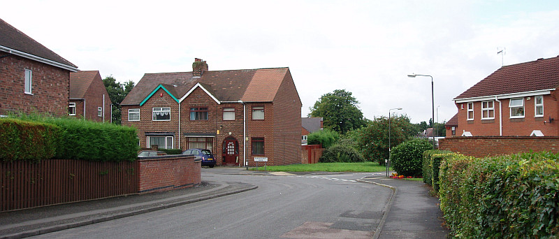
The start of Ravenscroft Drive for house numbering purposes. The side wall of no 1
is on the left. Across the road, behind the street name sign, is no 2, with a cul-de-sac
Rushcliffe Gardens on the right. The street in the foreground and behind the camera is
Rushcliffe Avenue. Photo taken by Gregg Marley in 2007.
A puzzle for historians was finding addresses 6 - 18, 118, 119, 121, 126, 128 and 129
Alport Drive in the 1936-37 electoral register. The following year's register also
contained 111 Ashover Avenue. It was obvious that Alport Drive and Ashover Avenue were
near each other and had been renamed, but where in Chaddesden were there two nearby streets
both long enough to have over a hundred houses? The mystery was solved by a visit to the
Local Studies Library where an estate plan for the Chaddesden Park Road Estate was found.
Alport Drive became Aylesbury Avenue and Ashover Avenue is the Aylesbury Avenue cul-de-sac.
The house numbers were builder's plot numbers for the entire estate. Aylesbury Avenue
is now numbered 1 to 25 from Madison Avenue to Margreave Road on the west side, and 2 - 50
on the east side which includes the cul-de-sac.
Those are a few examples of unusual house numbering in Chaddesden.
Look at your own street and those nearby and you may find more.
Peter Barnes
